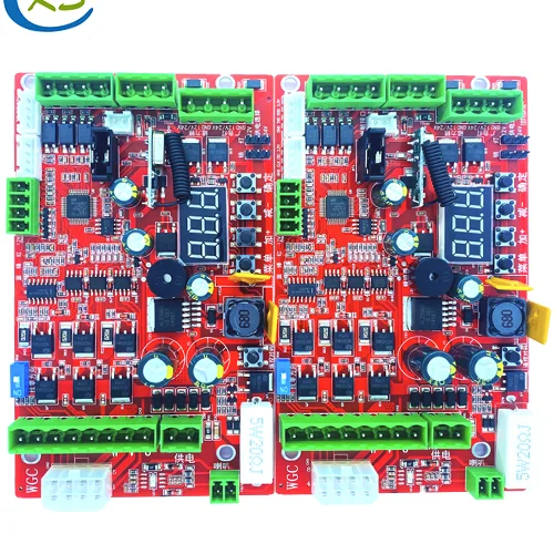

Bulk GPS circuit board assembly
Name: Bulk GPS circuit board assembly
Substrate: FR-4/High TG/Polyimild/PTFE/Rogers
Copper Thickness: 1/3OZ- 6OZ
Plate thickness: 0.21-6.0mm
minute. Hole size: 0.20mm
minute. Line width: 4 million
minute. Line spacing: 0.075 mm
Surface treatment: spray tin/gold drill/OSP/lead-free spray tin
Board size: minimum 10*15mm, maximum 508*889mm
Product Type: OEM&ODM
PCB standard: IPC-A-610 D/IPC-III standard
Certificate: ISO9001/ CE//TUV/ ROHS
Warranty: 1 year
Service: One-stop turnkey service
Electronic testing: 100%
Logistics: Air/Sea
GPS refers to Global Positioning System.
It can provide accurate positioning, speed measurement and high-precision standard time for most of the earth's surface (98%), and can satisfy military users located anywhere on the ground or in near-earth space to continuously and accurately determine three-dimensional position, three-dimensional For sports and time requirements, civilian GPS can also achieve a positioning accuracy of about ten meters.
Overview
Definition
The Global Positioning System (GPS) is a new generation of space satellite navigation and positioning system jointly developed by the US Army, Navy and Air Force in the 1970s. Its main purpose is to provide real-time, all-weather and global navigation services for the three major fields of land, sea and air, and to use them for some military purposes such as intelligence collection, nuclear explosion monitoring and emergency communications. It is an important part of the US global dominance strategy. This is a satellite system consisting of 24 satellites covering the globe. This system can ensure that at any time, any point on the earth can observe four satellites at the same time, so as to ensure that the satellite can collect the latitude, longitude and altitude of the observation point, so as to realize functions such as navigation, positioning, and timing. the
Introduction
GPS can provide functions such as vehicle positioning, anti-theft, anti-robbery, driving route monitoring and call command. To realize all the above functions must have three elements of GPS terminal, transmission network and monitoring platform.
Working principle
Positioning principle
The basic principle of the GPS navigation system is to measure the distance between the known satellite and the user's receiver, and then integrate the data of multiple satellites to know the specific position of the receiver. To achieve this purpose, the position of the satellite can be found in the satellite ephemeris according to the time recorded by the on-board clock. The distance from the user to the satellite is obtained by recording the time taken by the satellite signal to propagate to the user, and then multiplying it by the speed of light (due to the interference of the atmospheric ionosphere, this distance is not the real distance between the user and the satellite, but Pseudo-range (PR,): When the GPS satellite is working normally, it will continuously transmit navigation messages with pseudo-random codes (referred to as pseudo-codes) composed of 1 and 0 binary symbols. There are two types of pseudo-codes used by the GPS system, respectively It is the C/A code for civilian use and the P(Y) code for military use. The frequency of C/A code is 1.023MHz, the repetition period is 1 millisecond, and the code spacing is 1 microsecond, which is equivalent to 300m; the frequency of P code is 10.23MHz, and the repetition period is 266.4 days. The code spacing is 0.1 microseconds, which is equivalent to 30m. The Y code is formed on the basis of the P code, which has better confidentiality. The navigation message includes satellite ephemeris, working status, clock correction, ionospheric delay correction, and atmospheric refraction correction. and other information. It is demodulated from the satellite signal and transmitted on the carrier frequency with 50b/s modulation. Each main frame of the navigation message contains 5 subframes and each frame is 6s long. The first three frames each have 10 codes; It repeats every 30 seconds and updates every hour. The last two frames are 15000b in total. The contents of the navigation message mainly include telemetry code, conversion code, and data blocks 1, 2, and 3, the most important of which is ephemeris data. When the user receives the navigation message, extract the satellite time and compare it with his own clock to know the distance between the satellite and the user, and then use the satellite ephemeris data in the navigation message to calculate the position of the satellite when the message is launched , the user's position, velocity and other information in the WGS-84 geodetic coordinate system can be known.
It can be seen that the role of the satellite part of the GPS navigation system is to continuously transmit navigation messages. However, since the clock used by the user's receiver and the satellite's on-board clock cannot always be synchronized, in addition to the user's three-dimensional coordinates x, y, z, a Δt, which is the time difference between the satellite and the receiver, must be introduced as an unknown. Then use 4 equations to solve these 4 unknowns. So if you want to know where the receiver is, you must be able to receive signals from at least 4 satellites.
The GPS receiver can receive time information accurate to the nanosecond level that can be used for timing; the forecast ephemeris used to predict the approximate position of the satellite in the next few months; the broadcast ephemeris used to calculate the satellite coordinates required for positioning , the accuracy is several meters to tens of meters (different from each satellite and changes at any time); and GPS system information, such as satellite status, etc.
The distance from the satellite to the receiver can be obtained by the measurement of the code by the GPS receiver. Because it contains the error of the receiver's satellite clock and the error of atmospheric propagation, it is called pseudorange. The pseudo-range measured by CA code is called CA code pseudo-range, and the accuracy is about 20 meters. The pseudo-range measured by P code is called P code pseudo-range, and the accuracy is about 2 meters.
The GPS receiver decodes the received satellite signal or uses other techniques to remove the information modulated on the carrier, and then the carrier can be restored. Strictly speaking, the carrier phase should be called the carrier beat phase, which is the difference between the carrier phase of the received satellite signal affected by the Doppler frequency shift and the phase of the signal generated by the local oscillation of the receiver. Generally, it is measured at the epoch time determined by the receiver clock, and the phase change value can be recorded by keeping track of the satellite signal, but the initial value of the phase of the receiver and the satellite oscillator at the beginning of observation is not known, at first The phase integer of the first epoch is also unknown, that is, the integer ambiguity, which can only be solved as a parameter in data processing. The accuracy of the phase observation value is as high as millimeters, but the premise is to solve the ambiguity of the entire circle. Therefore, the phase observation value can only be used when there is a relative positioning and a continuous observation value, and the positioning accuracy better than the meter level can only be achieved. Phase observations can be used.
According to the positioning method, GPS positioning is divided into single point positioning and relative positioning (differential positioning). Single-point positioning is a way to determine the position of a receiver based on the observation data of a receiver. It can only use pseudo-range observations and can be used for rough navigation and positioning of vehicles and ships. Relative positioning (differential positioning) is a method to determine the relative position between observation points based on the observation data of two or more receivers. It can use either pseudo-range observation or phase observation. Geodetic survey or engineering survey should be Use phase observations for relative positioning.
The GPS observations include errors such as the clock error of the satellite and the receiver, the atmospheric propagation delay, and the multipath effect. The positioning calculation is also affected by the satellite broadcast ephemeris error, and most of the common errors are eliminated when performing relative positioning. offset or weaken, so the positioning accuracy will be greatly improved. The dual-frequency receiver can offset the main part of the ionospheric error in the atmosphere based on the observations of the two frequencies. When the accuracy is high and the distance between the receivers is long (the atmosphere has obvious differences ), a dual-frequency receiver should be selected.
The basic principle of GPS positioning is to use the method of spatial distance resection to determine the position of the point to be measured according to the instantaneous position of the high-speed moving satellite as the known starting data. As shown in the figure, assuming that a GPS receiver is installed at the point to be measured on the ground at time t, the time Δt when the GPS signal arrives at the receiver can be measured, and the following four factors can be determined by adding the satellite ephemeris and other data received by the receiver equations.
Positioning accuracy
28 satellites (including 4 spares) have already been launched into space, and they are distributed on 6 orbital planes whose intersections are 60 degrees apart, about 20,000 kilometers above the ground. The accuracy of stand-alone navigation is about 10 meters, and the accuracy of integrated positioning can reach centimeter and millimeter levels. But the accuracy of opening in the civilian field is about 10 meters.
Component
Space part
The space part of GPS is composed of 24 satellites (21 working satellites; 3 spare satellites), which are located in the sky above 20200km from the earth's surface, and the operation cycle is 12h. The satellites are evenly distributed on 6 orbital planes (4 on each orbital plane), and the orbital inclination is 55°. The distribution of satellites makes it possible to observe more than 4 satellites anywhere in the world at any time, and can pre-store navigation information in the satellites. Due to problems such as atmospheric friction, the navigation accuracy of GPS satellites will gradually decrease over time. .
ground control system
The ground control system consists of the Monitor Station, the Master Monitor Station, and the Ground Antenna. The Master Control Station is located in Springfield, Colorado, USA. The ground control station is responsible for collecting the information sent back by the satellite, and calculating the satellite ephemeris, relative distance, atmospheric correction and other data.
User equipment part
The user equipment part is the GPS signal receiver. Its main function is to be able to capture the satellites to be measured selected according to a certain satellite cut-off angle, and track the operation of these satellites. When the receiver captures the tracked satellite signal, it can measure the pseudo-range and distance change rate from the receiving antenna to the satellite, and demodulate the satellite orbit parameters and other data. According to these data, the micro-processing computer in the receiver can perform positioning calculation according to the positioning solution method, and calculate the latitude and longitude, altitude, speed, time and other information of the user's geographic location. Receiver hardware and built-in software as well as post-processing software package for GPS data constitute a complete GPS user equipment. The structure of the GPS receiver is divided into two parts, the antenna unit and the receiving unit. The receiver generally adopts two kinds of DC power sources, inside and outside the machine. The purpose of setting the internal power supply is to continuously observe without interruption when the external power supply is replaced. The internal battery is automatically charged when the external power supply is used. The built-in battery powers the RAM memory after shutdown to prevent data loss. Various types of receivers are getting smaller and lighter in size, which are convenient for field observation. The second is user receivers. There are currently two types of single-frequency and dual-frequency receivers. However, due to price factors, most users buy single-frequency receivers.
Market development
The market potential of China's GPS navigation is huge. By the end of 2005, there were less than 100,000 vehicles with on-board navigation equipment in China, and compared to the total number of 30 million vehicles, the penetration rate was less than 1%. In Japan, the car navigation installation rate is as high as 59%, and in Europe and the United States accounts for about 25%. In 2006, the portable navigation market should have a scale of nearly 500 million yuan. With the rapid development of the market and the emergence of new brands, it is estimated that the sales of China's car GPS navigation system terminals will be close to 10 billion yuan in 2009.
2008 is known as the "first year of 3G" in China. As we all know, in the field of domestic communications, the hottest is the TD-SCDMA——3G standard that is in trial operation. As a new generation of communication technology, 3G brings people a lot of expectations. The full issuance of 3G licenses has also become the focus of common attention. In fact, the domestic GPS navigation field is also undergoing a transformation. The third generation of PND navigation products has emerged as the times require, which has brought people into a new era of navigation.
The satellite navigation application industry is playing an increasingly important role in the national economy and will become the highlight of the Eleventh Five-Year Plan. During the "Eleventh Five-Year Plan" period, satellite navigation will be used in other fields such as aviation, sea, railway, construction, and telecommunications There will be a lot of room for development in applications such as electricity and electricity.
The development trend of satellite navigation technology is mainly manifested in three aspects: first, the coexistence of multiple systems of satellite navigation, which improves the availability of the system and expands the application field; second, the multi-component navigation technology is being promoted and applied, mainly including GPS and mobile communication The combined application of base station positioning, gyroscope, dead reckoning technology, etc.; the third is the combination of satellite navigation and other high technologies such as wireless communication, such as GPS receivers embedded in cellular phones, portable PCs, PDAs and watches, etc. Communication, security and consumer products Electronic products fundamentally promote the overall development of IT technology.
How to buy
Quality
When choosing GPS navigation products, the configuration of software and hardware is very important. Generally speaking, the hardware configuration of professional brand manufacturers is more trustworthy. Some counterfeit GPS manufacturers often fabricate hardware configurations, making it difficult to guarantee product quality in terms of LCD screens, GPS chips, and processors. The production process of their entire GPS product is nothing more than simple integration and assembly of some hardware. The hardware configuration of regular GPS manufacturers often has to go through layers of checks, and must pass ISO quality production standards (mainly ISO2000 quality certification, ISO14001 environmental certification) and other certifications. For automotive products, only through "ISO/TS TS16949 standard certification" can we supply products and services to Mercedes-Benz, Volkswagen and other automobile manufacturers.
Software
In terms of software, the most concerned is naturally the accuracy of GPS navigation map data and the timeliness of updates. Frequent updating of maps has resulted in high production costs of electronic maps, so many unqualified GPS manufacturers will reduce map updates or pirate other electronic maps. If consumers use "fake and shoddy" maps for machine navigation, they will not only easily "go astray", but may even be life-threatening.
Brand
In fact, the importance of the brand far exceeds the other. Since the satellite navigation industry in China is a high-tech industry in the development stage, only those professional manufacturers who have been working in the market for many years can guarantee the leading edge in product technology, and at the same time have the funds and strength to provide users with comprehensive and excellent service guarantee .
The price of the product and after-sales service are also the main factors to consider when purchasing a product. Consumers hope to buy high-quality and low-cost products, but the result may not be what they want. Many navigation products on the market are "cheap" but not "good quality". Therefore, consumers are reminded here not to be blinded by simply abnormal low prices when purchasing products. For navigation products that are closely related to your own driving travel and travel adventures, you must not be stingy to pay for your own "travel safety".
As a GPS navigation product, the upgrade of product technology and the update of map data are very important. Only professional brand manufacturers can provide consumers with such services in a timely manner.
Misunderstanding
After the third consecutive drop in oil prices, it ushered in a third consecutive rise. Newbies who just bought a car are even more worried that they will go the wrong way, and any fuel-efficient driving habits will be in vain. Therefore, after buying a car, more and more rookies will consider buying a car navigator. However, the reporter found that, in addition to the defects of the navigation product itself, car owners have some misunderstandings no matter in the static test when purchasing or in the actual application process.
Don’t be superstitious about the speed of star search when purchasing
Usually, in the store where the GPS navigator is purchased, the salesperson will show consumers how fast the product's satellite reception signal is. Usually, GPS is divided into three methods: hot start, cold start and warm start. However, in the process of selling navigators, some salesmen deliberately changed the concept and used GPS in different states to compare the search speed. Generally, when it is used for the first time, the battery is exhausted and the information is lost, or the receiving device is moved more than 1000 kilometers in the off state, the GPS cold start positioning speed is much slower than the hot start positioning speed.
In fact, many consumers value ultra-fast positioning, but the super-fast search star shown by the sales staff may not be really fast, because it is necessary to distinguish the different states of hot and cold starts. For example, some GPS products on the market are equipped with HotFix ultra-fast positioning technology. , Compared with other products without ultra-fast positioning technology, the positioning speed is more than twice as fast.
More languages are not more practical
In practical applications, in most cases, the voice of the product is used to navigate. Therefore, more and more products have an additional selling point of "multilingual selection". In addition to the most common Mandarin and English, Cantonese and Hakka also appear. , Chaozhou dialect, Northeast dialect, Sichuan dialect and other dialects. Therefore, some consumers feel that its "language ability" is super strong when purchasing. However, some consumers reported after using it that in fact, it is always Mandarin that can best express the actual situation on the road. Other languages only mechanically express simple information such as road names and distances in local dialects. Therefore, in the expression of navigation information, people feel weird.
Compare the route planning of ultra-distance attractions
When choosing a navigation product, the speed of its route planning and calculation speed is an important aspect to measure the quality of the product. Therefore, some consumers like to input local road information to test the operation of the product when purchasing, but this is not enough. You can try to set some extremely distant places, such as Tibet, Xinjiang, Inner Mongolia, Jilin and other tourist attractions as destinations, to test the calculation speed of the machine. Moreover, it is better to enter several more such remote destinations. During the use, the reporter found that if the Potala Palace in Tibet is set as the destination, some products can plan the route relatively quickly, but if some scenic spots in Jilin and Inner Mongolia are set as the destination and let it calculate, the product will gradually There is a phenomenon of slow operation or even crash. If the progress of each calculation state of the machine can be completed in a short time from 0% to 100%, it proves that its operation quality can be guaranteed. However, if some machines appear very slow or even crash when the display reaches 60%-70%, this kind of machine is obviously not suitable for consumers who like to travel by car.
Enter points of interest to compare the amount of map information
Most brands of GPS navigators on the market will choose a fixed electronic map provider to cooperate with. However, it should be noted that this kind of electronic map that meets the national publishing qualification generally has the same data information, but there are differences between the north and the south. Some companies’ electronic maps are aimed at the southern market. Therefore, users will find that the amount of information on some local points of interest will be very rich. Taking some real estate in the suburbs as an example, an electronic map that mainly focuses on the southern market, even The names of different districts can be displayed. And some electronic maps that focus on the northern market can't even find this real estate. Therefore, when purchasing, consumers can compare whether the information content of electronic maps of different products is rich according to their own needs. For example, after selecting Chancheng District, you can enter the names of some chain catering companies to see which one is more detailed in the same area. As a result, some maps showed two dozen, but others only showed a dozen.
Don’t judge the pros and cons of products based on familiar routes
When purchasing, many people will immediately input the departure and destination of their frequent driving to see if the route it guides matches their frequent driving route, so as to judge the quality of the product. Actually, this is not entirely true. Some car owners who often use the navigator said that under the premise of no traffic jams, the route recommended by the navigator is often closer. It can be seen that if the car owner is more familiar with the departure and destination, it is easy to doubt the guiding route of the navigator. However, although the route guided by the navigator is relatively close, there will also be situations where the road conditions guided by the navigator are extremely poor, or even difficult to pass.
GPS
Definition
The GPS positioning system refers to a system that uses satellites to perform real-time positioning and navigation around the world, referred to as GPS (Global Positioning System). The function of GPS positioning system must have three elements: GPS terminal, transmission network and monitoring platform; these three elements are indispensable; through these three elements, functions such as vehicle anti-theft, anti-robbery, driving route monitoring and call command can be provided.
Constitute
Space part
The space part of the GPS positioning system is composed of 24 GPS working satellites. These GPS working satellites together form the GPS satellite constellation, of which 21 are satellites that can be used for navigation, and 3 are active backup satellites. These 24 satellites are distributed around the earth in six orbits with an inclination angle of 55°. The orbital period of the satellite is about 12 sidereal hours. Each GPS working satellite sends out a signal for navigation and positioning. It is these signals that GPS users use to do their work. It can be seen that the function of the satellite part of the GPS positioning system is to continuously transmit navigation messages.
Control section
The control part of the GPS positioning system is composed of a monitoring system composed of several tracking stations distributed around the world. According to their different functions, these tracking stations are divided into master control stations, monitoring stations and injection stations. The function of the main control station is to calculate the satellite ephemeris and the correction parameters of the satellite clock based on the observation data of the GPS by each monitoring station, and inject these data into the satellite through the injection station; Control, issue instructions to the satellite, when the working satellite fails, dispatch the spare satellite to replace the failed working satellite; in addition, the main control station also has the function of the monitoring station. The role of the injection station is to inject the satellite ephemeris and satellite clock corrections calculated by the master control station into the satellite.
User part
The user part of the GPS positioning system is composed of a GPS receiver, data processing software and corresponding user equipment such as computer meteorological instruments. Its function is to receive signals from GPS satellites and use these signals for navigation and positioning.
The above three parts together form a complete GPS positioning system.
Features
The GPS positioning system has the characteristics of good performance, high precision and wide application. It is the best navigation and positioning system so far. With the continuous improvement of the global positioning system, the continuous improvement of hardware and software, the application field is constantly being developed, and it has spread to various sectors of the national economy, and has gradually penetrated into people's daily life.
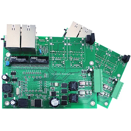
Kingford provides Bulk GPS circuit board assembly services. This is a PCBA one-stop assembly factory with senior industry experience. Welcome to know us.
")
Name: Bulk GPS circuit board assembly
Substrate: FR-4/High TG/Polyimild/PTFE/Rogers
Copper Thickness: 1/3OZ- 6OZ
Plate thickness: 0.21-6.0mm
minute. Hole size: 0.20mm
minute. Line width: 4 million
minute. Line spacing: 0.075 mm
Surface treatment: spray tin/gold drill/OSP/lead-free spray tin
Board size: minimum 10*15mm, maximum 508*889mm
Product Type: OEM&ODM
PCB standard: IPC-A-610 D/IPC-III standard
Certificate: ISO9001/ CE//TUV/ ROHS
Warranty: 1 year
Service: One-stop turnkey service
Electronic testing: 100%
Logistics: Air/Sea
- Previous:No
- Next:Mass touch screen motherboard assembly